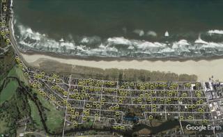
Spatial Distribution
Although the City of Seaside does not have a cap on the total number of VRDs, current policies set limits on the amount of VRDs allowed within 100' of an applicant's property. The density requirements are set depending on the zone the property is located in. Properties that are on or near the ocean front may allow for higher densities of nearby VRDs.
Properties located within the Resort Residential (R-R) zone do not have a density requirement as an outright use for properties in this zone is as a hotel/motel for short term lodging. VRDs permitted in the R-R zone do not count against an applicant's density whose property may abut that zone.
An applicant property located in Medium Density Residential (R-2) or High Density Residential (R-3) zones and not located on the ocean front may be subject to policies ensuring no more than 30% or 50% (depending on the property's location within the zone) of the surrounding properties within 100' of the applicant's property line are already permitted VRDs. Properties located outside of the R-R zone but along the oceanfront are not subject to the density limitation however, these properties are still subject to Planning Commission review if the density is more than 20%.
Here is a map of the 30%, 50%, and 100% spatial distribution areas.
The density of VRDs surrounding an applicant's property determines the applicant's requirement to appear at a public hearing at a Planning Commission meeting. If the surrounding density is over 20% the application goes to the Planning Commission for review. If the surrounding density is 20% or less the review is conducted by the Planning Director. Public notice is sent to all property owners within 100' of the applicant's property lines to allow public comment on all land use decisions.
Density is determined by calculating the number of VRDs within 100' of the applicant's property lines and dividing that number by the total number of properties within that same 100' line excluding the applicants property. Clatsop County Webmaps can be used to determine the number of properties surrounding an applicant's property. Use the VRD local contact map to determine the number of surrounding properties that are already permitted vacation rentals.