Seaside Evacuation Maps
A Quick Guide Seaside's 5 Routes
An overview of Seaside's routes to high ground.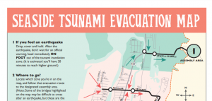
Pedestrian Walking Map
The arrow color indicates how fast you must travel to reach safety.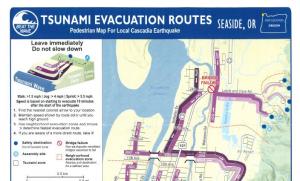
Revised Inudation Map 2021 DOGAMI
Local and Distant Tsunami Coverage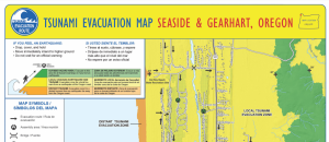
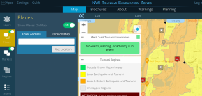
Interactive Online Tsunami Map
Online map showing the fastest route from any address on the Oregon Coast.